A Day in the Life of a Navigator » Estimated Position
Two Sun lines can be used to provide an estimated position. For our example, Chief Sheedy plots a new estimated position (EP) at 32° 05' N 055° 00.0' W, then plots future DR positions from this estimated position.
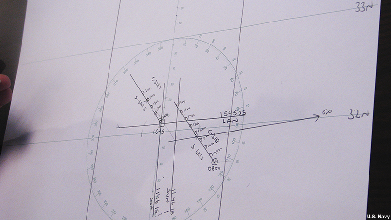
We can now get an estimated position using the two Sun lines and our DR position. In Navy parlance, the term estimated position is used when we have incomplete data or data of questionable accuracy. Having less than three lines of position constitute incomplete data. Once a third LOP is determined, we will then have a fix. A square is used to symbolize an estimated position on a chart.
Chief Sheedy demonstrates marking estimated position on the plot.
Chief Sheedy: In our example, our new estimated position is 32 degrees 5 minutes North. 055 degrees 0 minutes West. Since there are two lines of position intersecting, that’s considered an estimated position, since it’s not three. At least three LOPs equal a fix. Since it is estimated position, I label it with a square. Mark the time, 15:45. In our example, our new estimated position is 32 degrees 5 minutes North. 055 degrees 0 minutes West.
A new DR is started from that position. Course 318, 6 knots. Every hour on the hour: 1600, we’ll be at this position with a half circle around it. From there, we’re doing 6 knots: 17, 18, 19, 20. Course 318 true. speed 6 knots. That is our estimated position and dead reckoning.