A Day in the Life of a Navigator » Local Apparent Noon
The Sun crosses our meridian at noon; more precisely, at Local Apparent Noon, also called LAN. At this moment, the Sun appears to us to be at its highest point in the sky for the day. In other words, its altitude is at its largest. Also at this moment, the Sun is either due North, or due South of us.
(Well, it’s possible that it is directly overhead, but this is very, very unlikely). This means that our line of position observed at this moment will run exactly East-West.
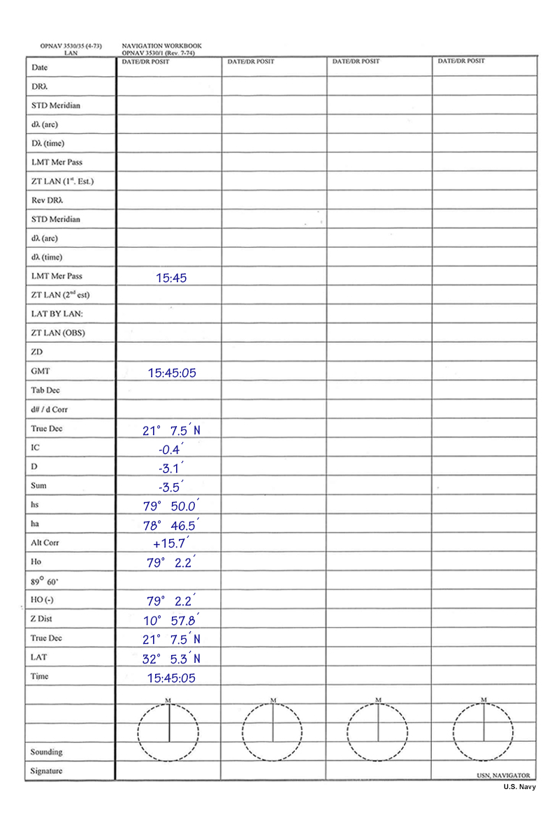
A LAN observation not only provides us with another Sun line, but this Sun line is a measurement of our latitude. Because our local apparent noon LOP runs directly East-West, this is equivalent to measuring our latitude. You could go through all of the steps for a full sight reduction. However, it is actually easier than that, and a different strip form is often used specifically for a LAN measurement. Our latitude is simply the Sun's zenith distance, plus or minus the Sun's Declination. Because a strip form is used, you do not need to memorize this formula: Latitude = Zenith distance(Sun) +/- Declination(Sun).