A Day in the Life of a Navigator » Observing LAN » Plotting the LAN Line of Position
The LAN sight provided an observed latitude of 32° 05.3' N. On the plotting sheet, Chief Sheedy plots the LAN line, which runs exactly east-west.
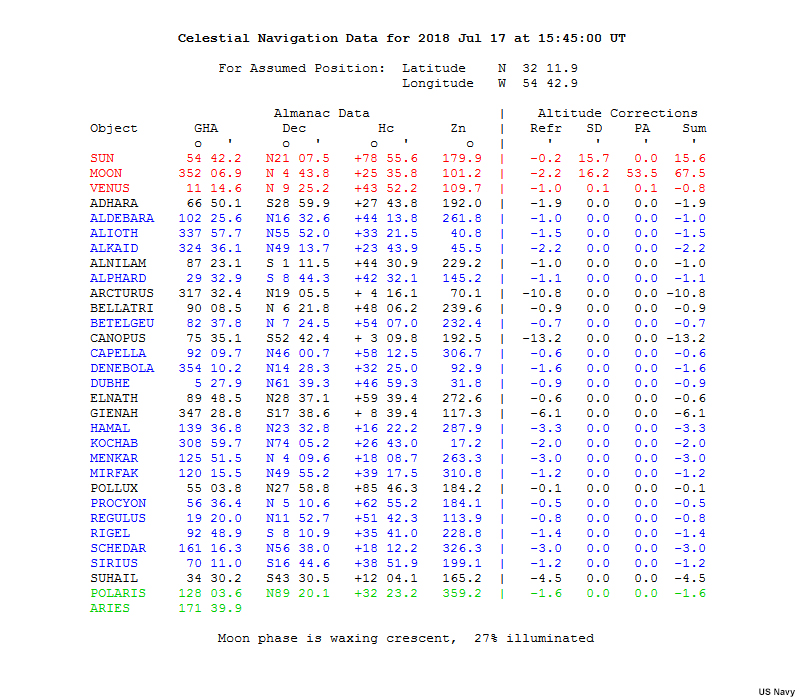
The Sun's true Declination at time of LAN can be found on the U.S. Naval Observatory web site. Without internet access, we could use The Nautical Almanac.
In our example, True Declination is 21 degrees, 7.5 minutes north.
To get our latitude, we either add the Declination to the zenith distance, or subtract it, depending on a few rules.
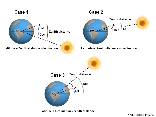
In our case, we add, and we find our latitude is 32 degrees 5.3 minutes north.
Because a LAN line of position runs exactly east-west, it is easy to plot at our current DR position.
Chief Sheedy: We’re now ready to plot our latitude for local apparent noon, at time 15:45.
The latitude at time 15:45 was 32 degrees 5 decimal 3 North. Label properly: 15:45, LAN (Local Apparent Noon) underneath. This is our line of position for LAN.
We’ll also advance that morning Sun line to the local apparent noon latitude to obtain an estimated position.
