Pressure Altitude and Density Altitude

The crew aboard the Kearsarge has some aircraft exercises planned for this morning. They want to know the pressure altitude and density altitude so that they can pass that information along to the pilots.
From your measured variables—station pressure, sea level pressure, and altimeter setting—you can compute pressure altitude and density altitude.
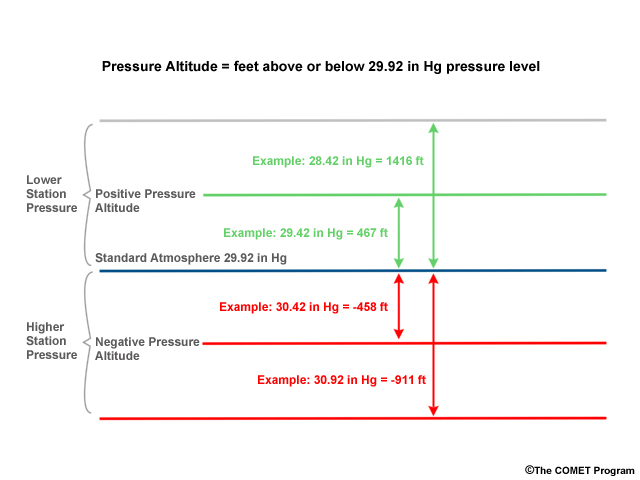
Pressure altitude represents the height above or below sea level that a given pressure would occur and is reported in feet. In standard atmosphere conditions (sea level temperature: 15 degrees C, pressure 1013.25 hPa or 29.92 in Hg), the pressure altitude reflects the true altitude (in feet) above sea level. In non-standard conditions, the pressure altitude reflects the altitude (in feet) above the 29.92 in Hg pressure level.
Values for pressure altitude are determined for local use to support aircraft operations. Pressure altitude is also needed to compute the density altitude, which provides a correction for non-standard temperature conditions and depends on air temperature, station elevation, dewpoint, and station pressure. These values are important because an aircraft altimeter reports an indicated altitude based on its altimeter setting.
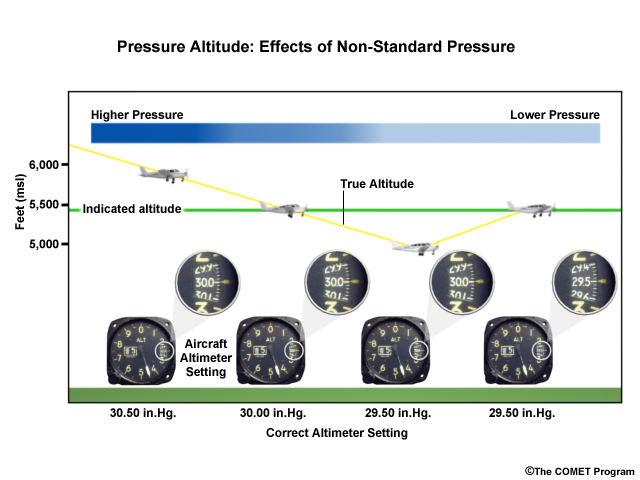
In the case illustrated in the schematic, the indicated altitude for altimeter setting 30.00 is shown to be around 5500 feet. However, if the atmospheric pressure is higher and the altimeter setting does not reflect this, the planes true altitude (yellow line) will be higher than the indicated altitude. If the atmospheric pressure is lower, the planes true altitude will be lower than indicated until the altimeter is corrected to the correct pressure setting.
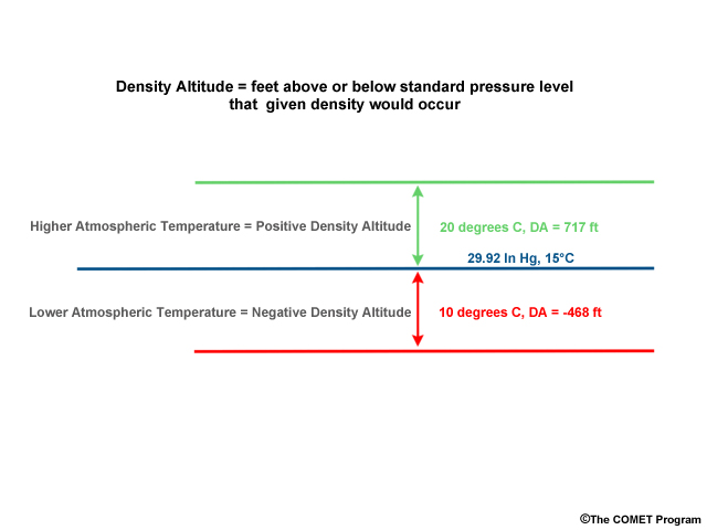
Density altitude is very useful for aviation operations and represents the height (in feet) above or below sea level that a given density would occur based on a standard atmosphere.
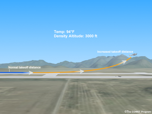
Essentially, the density altitude provides a measure of the altitude the airplane will think it is at and performs in accordance with. If the density altitude is 3000 feet, airplanes will take off in atmospheric conditions similar to those they would be calibrated for at 3000 feet, which could lead to decreased engine performance.
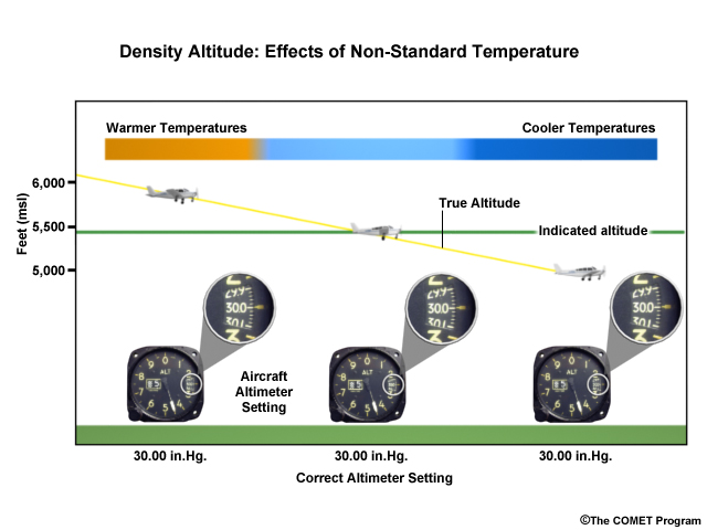
Density altitude provides a correction for non-standard temperature values given that very cold or very warm air will have different densities, which will affect the plane's performance. When the air is very cold, the density increases and the density altitude value is negative. The plane's altimeter will report an indicated altitude (green line on figure) that is higher than the true altitude (yellow line). When the air is very warm, the density will decrease and the density altitude is positive. In this situation, the altimeter will report an indicated altitude (green line) that is below the true altitude (yellow line).