Flow Interaction with TopographyTopography
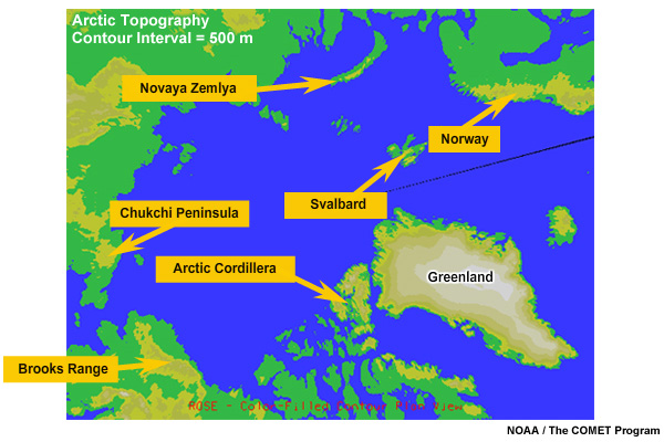
This map shows Arctic areas over 500 meters elevation in shades of yellow. The edges of these areas are most likely to see topographically influenced winds. The most prominent areas include the Brooks Range, the Arctic Cordillera, Greenland, and Norway. Smaller areas include Svalbard, Novaya Zemlya, and the Chukchi Peninsula.