Arctic CyclonesClimatology - Winter
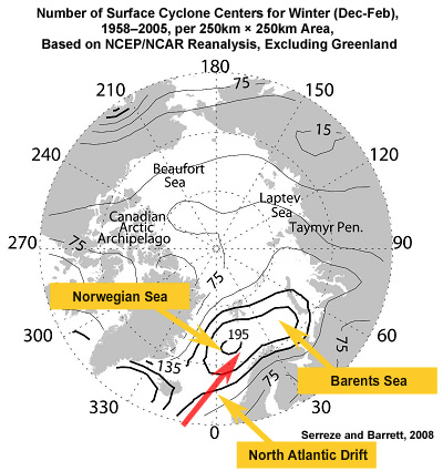
The formation and intensification of cyclones is associated with strong temperature gradients. In the Arctic, these gradients typically form near the boundaries of open water.
This graphic shows the number of cyclones detected in winter per 250km x 250km area over the 47-year period of 1958–2005. In the winter, cyclones mostly occur over the warm North Atlantic drift that flows up into the Norwegian and Barents Seas, which correlates well with the Icelandic Low.
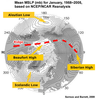
Storms in the North Pacific, associated with the Aleutian Low, are typically blocked from entering the Arctic by the surface ridge that extends from Siberia, across the Arctic Ocean, to northwest Canada. Instead, these storms tend to track into the Gulf of Alaska.
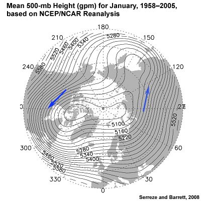
Cyclones that form over Eurasia or North America tend to be steered to the southeast by upper level winds. Few storms form or intensify over winter sea ice, though storms may drift over the ice and dissipate.