OceanographySilled Basin
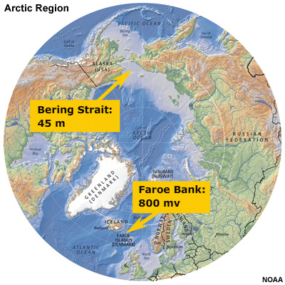
When we look below the surface, we see that the flow of water in and out of the Arctic is severely limited by the bathymetry. The Arctic Ocean is termed a “silled” basin because a submarine ridge separates the Arctic from the Atlantic. Between Canada and Scotland, the deepest channel is only 800 meters deep. The connection with the Pacific Ocean through Bering Strait is only 45 meters deep. As a result, there is no exchange of deep water between the Arctic and the rest of the world’s oceans.