Arctic CyclonesFormation of Summer Cyclones
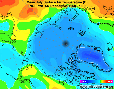
When spring arrives and daylight returns to the Arctic, the thin snow cover quickly melts from land. With snow gone, land warms quickly. The sea ice covering the ocean melts slowly, keeping ocean temperatures cool. As a result, there is a strong temperature gradient along the coast, as seen here, resulting in a stationary front. The coastline in the Arctic runs east-west from Western Russia, all the way east to the Canadian Archipelago. As a result, the stationary front separates large reservoirs of cold air to the north from warm air to the south.
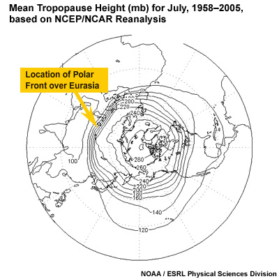
Most of the summer cyclones in the Arctic originate in two places: (1) along the Polar Front over land in northern Eurasia or (2) as tropospheric waves ripple along the coastal front. As these disturbances migrate along or over the coast, they induce warm offshore flow. The warm air evaporates water from the melting sea ice, destabilizing the lower atmosphere and generating or enhancing low pressure. On the backside of the low, cold dry air off the polar ice cap is drawn in, enhancing the lift along the surface frontal boundary.
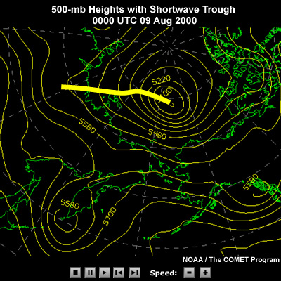
Meanwhile, aloft, a series of long waves and short waves migrates in an easterly direction around the Polar Vortex, like we see in our scenario case. As these long waves and short waves sweep along the east-west coast line, their troughs and ridges alternately generate lift or subsidence. Cyclones are triggered when the lift from a trough aloft comes into phase with a surface low along the coast. The resulting cyclone now tracks parallel to the coast, steered by winds aloft. The cyclone can strengthen, even deepen explosively, in response to the interaction of cold Arctic air to the north and warm continental air to the south as upper level winds drive the low on an ENE trajectory.
The Arctic is a data sparse region, so numerical models can miss the explosive deepening of a cyclone. A solid understanding of models, their limitations, and extensive use of satellite data is the only way to produce a consistent, accurate forecast.