Arctic ClimateSynoptic Patterns
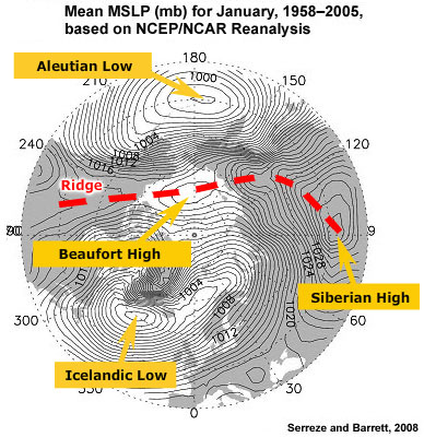
The synoptic picture of the Arctic is dominated by only a few features. In winter we find lows over the North Atlantic (Icelandic Low) and North Pacific (Aleutian Low). These lows are separated by a ridge composed of the intense Siberian High and the weaker Beaufort and North American Highs. It is important to understand that the Aleutian and Icelandic Lows are climatological features reflecting the high frequency of lows in the area. On a day-to-day basis these lows can be located anywhere across a broad region. The Siberian High is an intense, shallow, cold anticyclone that forms in response to radiational cooling over eastern Siberia in winter. It is associated with frequent cold air outbreaks over East Asia.
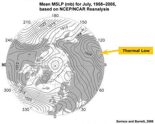
In summer, the Siberian High is replaced by a thermal low. The Aleutian and Icelandic Lows nearly disappear as the frequency of cyclones in the northern oceans drops considerably.