Arctic ClimatePolar Vortex
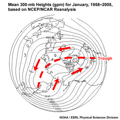
Heights of pressure surfaces are much lower in the Arctic than at mid latitudes. This results in a persistent large-scale, cyclonic circulation pattern in the middle and upper troposphere called the polar vortex. This feature is present over both the north and south poles. In the Arctic, the vortex is rather elongate with troughs over eastern North America and eastern Asia. As we have seen earlier, the polar vortex is not present at the surface; rather, it becomes a coherent feature only at about 500 mb and higher.
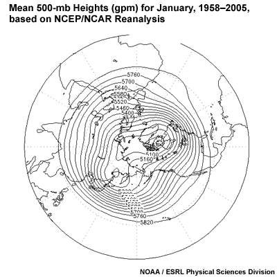
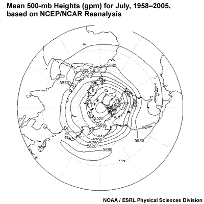
If we compare the winter and summer Arctic polar vortex, we can see that the vortex contracts and the gradient decreases significantly in the summer. This occurs due to warming of the Arctic, which causes the heights of pressure surfaces to rise.