Table of Contents
Fog/Stratus/Visibility
Fog/Stratus/VisibilityFog as a Serious Danger
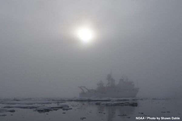
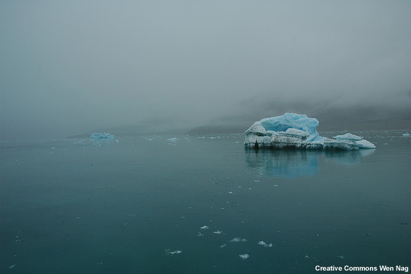
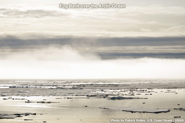
Over the cool water of the Arctic Ocean, fog occurs frequently, particularly during the summer months when waters are ice-free. Throughout the Arctic, fog frequency, as well as stratus frequency, peaks in June and July.
Fog occurs most frequently along the coastal areas, typically in a belt parallel to the shore where strong horizontal temperature and moisture gradients exist between ice, water, and land.
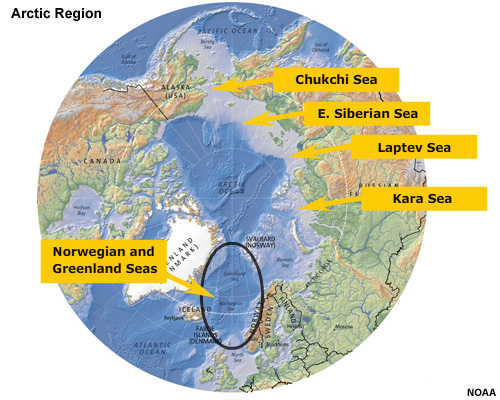
The high frequency of occurrence for fog directly affects heavily used shipping lanes from the Atlantic into the Norwegian and Greenland Seas. Additionally, the open waters of the Kara, Laptev, East Siberian, and Chukchi Seas are particularly conducive to summer fog or low cloud formation. During a typical summer, these areas might experience fog 15 to 20 days per month. The Bering Sea is also affected by summertime fog and stratus, as southerly flow brings warm, moist air northward.
In several areas of the Arctic, as many as 80 to 95% of summer days can be overcast, making the Arctic one of the cloudiest regions in the Northern Hemisphere.
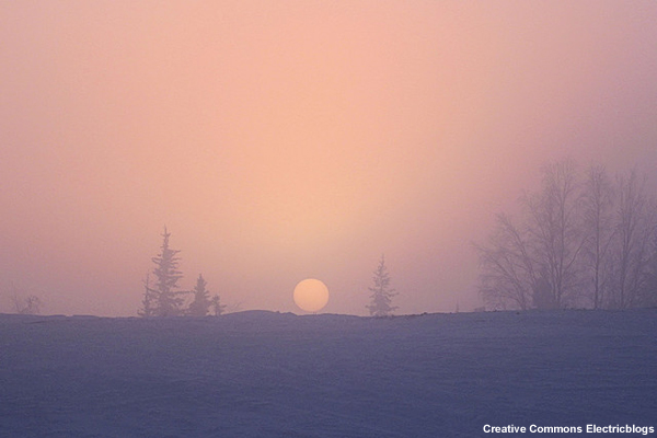
In the winter, fog is more likely over the adjacent land areas, which can become colder than the ice-covered ocean. Winter also brings the risk of ice fog, composed of minute ice crystals,
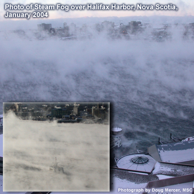
And steam fog, a phenomenon that occurs when the air temperatures are significantly colder than the water temperature. Steam fog, also known as sea smoke, occurs over open water, including leads or passages in the ice pack.
Fog/Stratus/VisibilityFog Development
The atmospheric conditions necessary for fog formation in the Arctic are similar to those at lower latitudes. Essentially, a temperature inversion helps hold moisture at the surface and limits mixing. In the Arctic, when relatively warm air is advected over cold sea water or sea ice, it cools from the surface up, forming an inversion. Also, subsidence around the periphery of high pressure centers and along the ridges associated with those centers promotes inversions. Because of the very cold ocean waters in the Arctic, the meager sunlight is not enough to mix out the inversion, allowing fog to persist for extended periods.
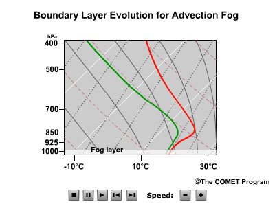
Fog/Stratus/VisibilityAdvection Fog
Advection fog, common in the Arctic, occurs when air is transported from over a warmer surface to over a cooler surface. The air mass might have a high relative humidity prior to advection, or the cooler surface can also be a moisture source. With enough humidity and enough cooling, the air saturates and fog forms.
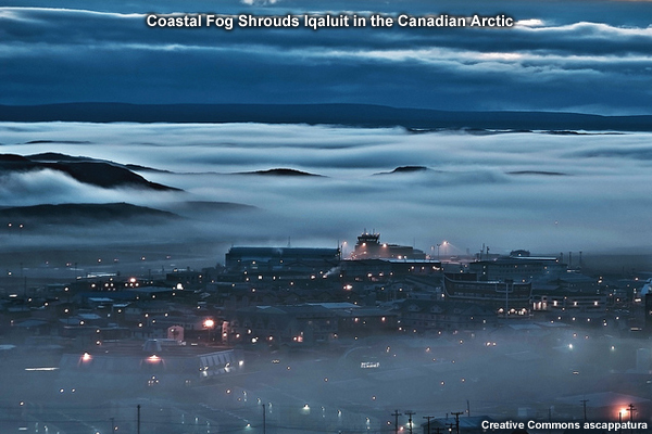
The irregular coastlines of the Arctic help set the preconditions to this fog formation. Boggy tundra and open ocean provide moisture. The cold ocean promotes formation of a low-level inversion. The coastline provides strong temperature gradients so that fog can form as air flows on and offshore.
Fog/Stratus/VisibilityOther Fog
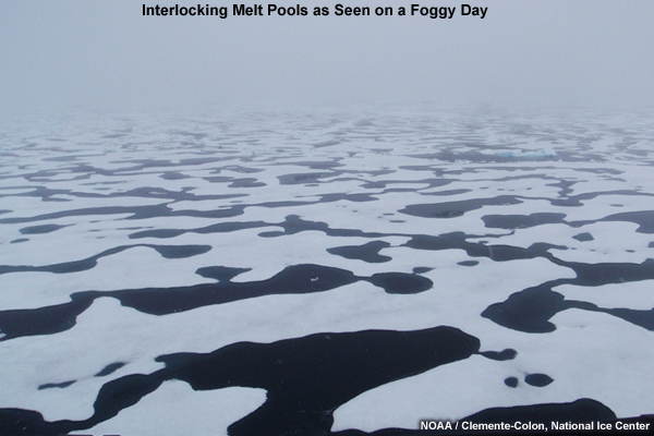
Fog can also form in place, without advection. If winds are light, a strong inversion can form over the pack ice. When the pack ice is melting, melt ponds provide moisture. Evaporating melt ponds and boundary layer mixing eventually lead to saturation, forming fog. Like advection fog, this condition persists until clearing occurs due to turbulent mixing from strong winds or a frontal passage.
Fog/Stratus/VisibilityForecasting Fog & Visibility
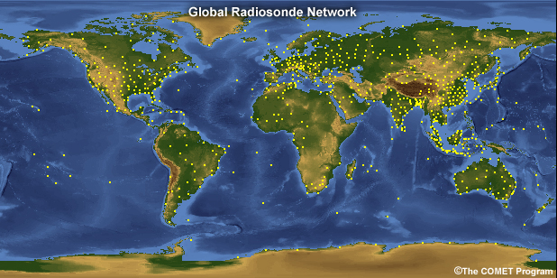
Even with a thorough understanding of fog processes and conditions, forecasting fog and visibility in the Arctic is complicated by the uncertainty in model estimates. This uncertainly is influenced in part by a lack of data, and particularly by a dearth of microphysical observations at extreme northern latitudes. For example, this map shows global radiosonde locations. Note the paucity of soundings from the Arctic. Studies have shown that errors on the order of 20 to 30 percent in relative humidity or liquid water content can result in a 50 percent uncertainty in projections of visibility.
Fog/Stratus/VisibilitySatellite Detection of Fog
A lack of good surface observations limits the amount of information about conditions both upstream and along a proposed navigation route, but data from polar-orbiting satellites can help identify stratus or fog. At infrared wavelengths, status cloud or fog will appear darker than surface ice or snow cover because the top of the cloud layer will be warmer than the surface. What is not always straightforward is determining the vertical extent of the stratus layer—that is, does the cloud deck extend to the surface as fog. In many cases, these observations do not provide enough information about cloud height and thickness to distinguish between the often-present stratus cloud and fog.
Fog/Stratus/VisibilityUsing Climatology
Particularly when first beginning to forecast in the Arctic compared to lower latitudes, climatology can be a useful tool to help verify your predictions. By comparing your analysis with previous events, you can develop a better idea of whether fog is expected, as well as what the character of the fog will be. Once this initial assessment is complete, conditions should be monitored and the forecast reassessed and adjusted as necessary.
For more details on fog formation processes and fog forecasting, see these modules:
Dynamically Forced Fog (see pages on Concept, Examples, and Forecasting DFF)
Advection Fog
Steam Fog
Synoptic Weather Considerations: Forecasting Fog and Low Stratus (see pages on Marine Events)
Fog/Stratus/VisibilityQuestions
Question 1
When does the peak frequency of fog/low stratus occur in the Arctic? (Choose the best answer.)
The correct answer is c) "summer."
In summer, moisture is abundant and temperature gradients are strong, particularly along the coast.
Question 2
Match the type of fog to the mechanism of formation. (Use the selection box to choose the answer that best completes the statement.)
a) Warm moist air passes over a cold surface matches "Advection Fog".
b) Cold dry air passes over warm water matches "Steam Fog".
c) Water vapor suspended in air freezes matches "Ice Fog".
Question 3
Which of the following factors most hampers fog forecasting in the Arctic? (Choose the best answer.)
The correct answer is a) "Dearth of observations."
Very few weather observations are made in the Arctic, and even fewer soundings are taken. The Arctic region is covered by global weather models, in addition to some Arctic–specific mesoscale models. And while geostationary satellite fail to adequately image the Arctic, polar-orbiting satellites provide frequent images at high latitudes.
Question 4
Use the selection boxes to choose the answers that best complete the statements.
The correct answer is warmer.
Due to the strong inversion, the top of the cloud or fog will be warmer than the surface.
Fog/Stratus/VisibilityReferences
COMET modules on Fog and Low Stratus: http://www.meted.ucar.edu/topics_fog.php
Arctic Marine Geography, Climate and Sea Ice http://www.Arctic.gov/publications/AMSA/Arctic_marine_geography.pdf
Arctic Climatology (Ch 3 of Navy Forecaster Handbook) http://www.nrlmry.navy.mil/forecaster_handbooks/Arctic/Forecasters Handbook for the Arctic.03.pdf
Gultepe et al., Visibility Forecasting for Warm and Cold Fog Conditions Observed During FRAM Field Projects, Aviation, Range, and Aerospace Meteorol., AMS Annual Meeting, 2009. http://www-pm.larc.nasa.gov/icing/pub/conf/Gultepe.etal.eabs.AMS.09.pdf