Aug 04, 2000 Planning
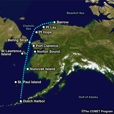
Our passage will take us from Dutch, past Nunivak Island, through the Bering Strait and up to Barrow. The coast of Southwest Alaska offers excellent shelter for ships in transit up to the Bering Strait. There are numerous islands to offer a protection on their lee side and some well established harbors for better shelter if necessary.
North of the Bering Strait is a different story. The coastline is pretty rugged and remote with few adequate harbors. In the event of severe weather the ship must be prepared on short notice. Sailing time to the Bering Strait is expected to take 3 days with 2 more days to Barrow. If conditions will not permit a transit within wind and sea limits, then the Captain will divert into Port Clarence and hold up or remain at sea south of the strait itself.
Since I've never been north of the Arctic Circle, I review the geography of the Arctic while I have the charts and maps handy.