Aug 09, 2000Weather Update
Later that evening, as the weather began to deteriorate, the captain called me. He has to decide whether to continue north or not. So it's back to the charts.
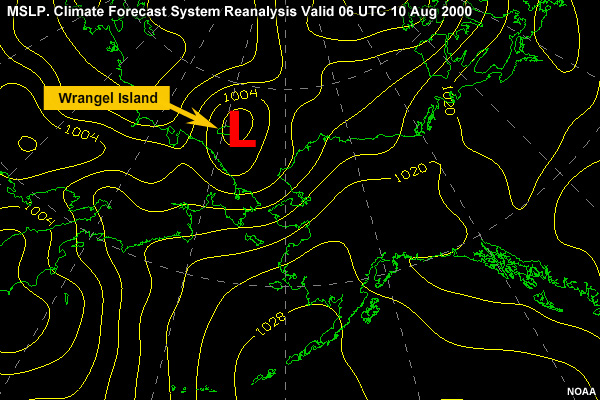
Looking at the low developing over Wrangel Island, the captain wants to know the worst case scenario.
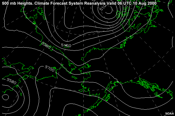
It looks like the upper-level trough has caught up with the surface low, which is just coming off the coast. With additional lift from the trough aloft, it appears that the surface low has deepened much more than the models predicted.
If this keeps up, the storm could generate a stronger southwest wind of 35 kt, gusting to 45 kt with seas of 15-20 feet from the southwest. This places the ship at its maximum limits and it could seriously hammer the cutter.
The Captain decides to slow the advance and wait for the low to clear out of the ship's path. The cutter informs the Coast Guard district command of its intentions. The district concurs: there are no pending search-and-rescue or legal cases requiring the ship to arrive off the Port of Barrow.