Aug 05, 2000 Near St. Paul Island
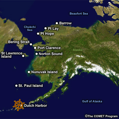
We left Dutch Harbor at dawn and are steaming north.
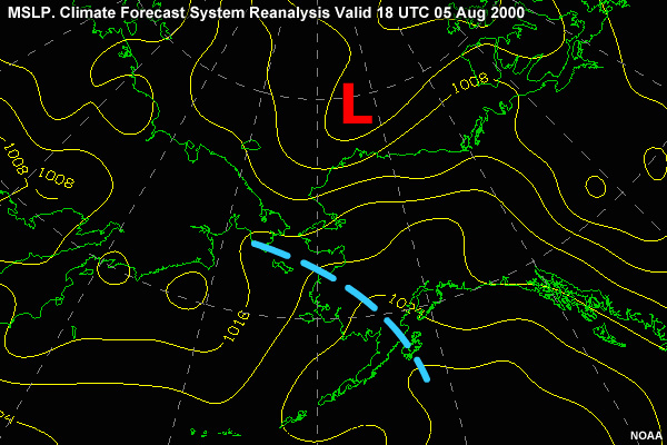
Looking at the surface chart we see the ridge of high pressure building over the eastern Bering Sea from the northern Pacific as the low moves northeast to the Barrow area.
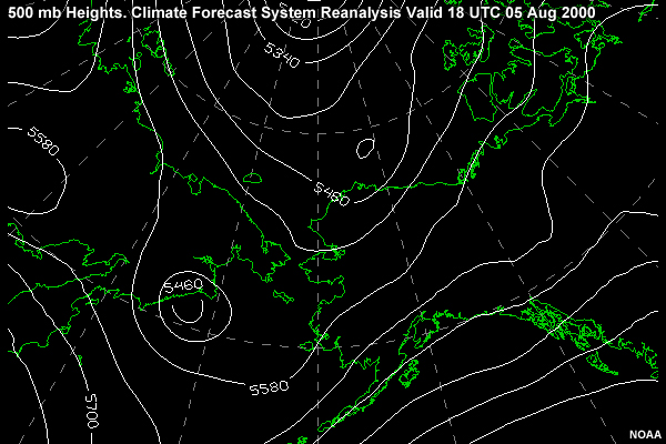
A quick check of the 500-mb chart shows the corresponding height rises, consistent with the low moving out ahead of the ridge.