Aug 10, 2000 Storm
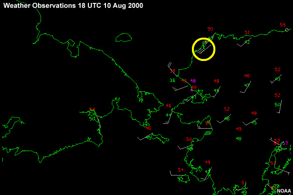
0400 (1200 UTC) on the morning of August 10th, the wind veered to WSW from SW and increased to 40 knots. I met the Captain on the bridge. Clearly, I'd busted the forecast. The models missed the deepening and, in hindsight, I should have been more cautious in my forecast, especially with a low crossing in front of us.
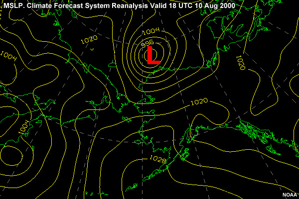
The Captain ordered the ship to head west to more open waters west of the Alaskan coast line. By mid morning, the 1200Z model run showed a much deeper surface low (992 mb)
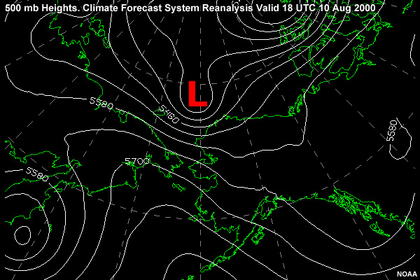
and a slightly deeper 500-mb upper level trough. The 500-mb trough was moving over the surface low.
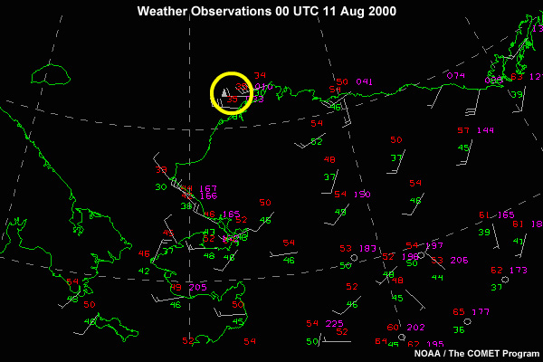
Now it's 4PM (00 UTC 11 Aug) and the wind has risen to 50 knots from the west, with gusts to 60 knots. Seas have risen to 15-18 Ft, also from the west. We now know the low pressure system is not the expected gale forecast earlier. The decision to slow was indeed fortuitous, as it kept the ship further from the center of the surface low.
I contact the Naval Maritime Forecast Center in Pearl Harbor to discuss our situation. Pearl Harbor is unaware of the events and places a coordination call with the National Ice Center for additional data.
Next the NMFC CDO contacts the NWS Office in Fairbanks. With only limited data to work from, they too, are unaware of the severity of the storm in the Chukchi Sea. They thank us for the hourly obs and update the forecast.