Aug 07, 2000The Forecast
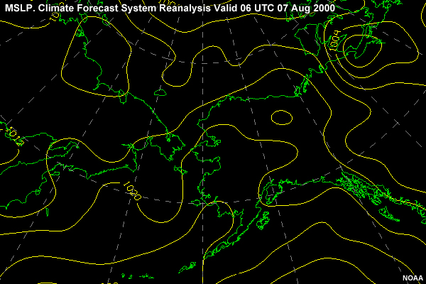
Looking at the charts, at 07/0600z Aug, I see sea level pressure dropping to the north to a low near the North Pole. There is a weak ridge from the Russian Arctic coast to the northern Bering Sea.
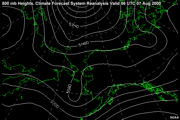
Looking at the 500-mb chart, we see one longwave trough over the western Bering Sea and another over Siberia. The ridge over the Pacific and the eastern Bering Sea continues to hold stationary and acts as a block for lows moving from the west to the east.
After I gave the captain this summary, he asked for a "window" to steam without encountering much in the way of weather or ice. Once in the Barrow area there are few sheltered locations that reduce the weather's impact on the ship. Since it appears that conditions will remain moderate, I advise the Captain that this would be a good time to move the ship north to the area off Barrow. However, there is a low even farther east that presently doesn't amount to much. Should that low track east and deepen, it could present a problem for the ship. Cyclones are not unknown in these parts and can result in high winds and seas.