Aug 04, 2000 Current Weather
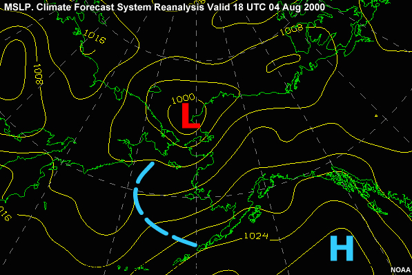
Now I pull the weather charts and study the weather located ahead over our track and off to the west. Looking at the 04/18Z surface chart, we find high pressure located over the North Pacific with a weak ridge of high pressure located over the ship's track. A weakening low pressure system is located over Kotzebue Sound.
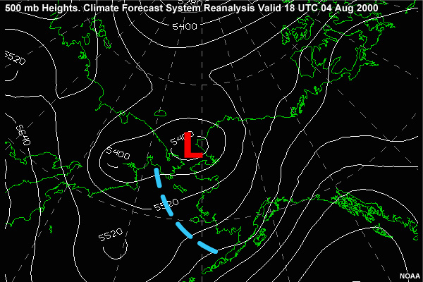
The 500-mb chart shows the ridge over the Gulf of Alaska is vertically stacked with height and thus not moving. The upper level low north of the Nunivak area has height rises as well and is filling. This is reflected on the surface as the low there also fills and drifts north.
I also check the forecasts available from the Naval Maritime Forecast Center in Pearl Harbor and the maritime forecasts from the NWS in Anchorage, Alaska. The following is forecast for the next 48 hours:
Sky: Overcast stratus
Visibility: Unrestricted, temporary 100 ft obscured
Wx: Intermittent Drizzle & Fog
Wind: SW @ 13-18 knots
Comb. Seas: SW 5 - 7 ft
Barometer: Falling slowly