Basics » Lines of Position
When looking at a large area of Earth, it is easy to see why the arcs centered at a geographic position are called "circles of position".
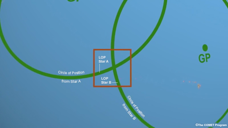
Finding our position using traditional celestial navigation relies on graphing our position on a chart. And using a large area, such as a globe, is not very good for graphing precise positions. Therefore we tend to look at a much smaller region. Within a small area of maybe a few hundred miles, we’ll often see only a small arc of the "circles of position", which tend to look more like lines than circles. In fact, this is very useful because dealing with lines is much easier, mathematically and graphically, than dealing with circles. If we can limit ourselves to dealing with a small arc of a circle, we can treat it as a straight line, which we call a line of position, or LOP. Our position is at the intersection of the lines. This is called a fix.
This is another important concept you should remember: when we draw a line of position on a chart, our location is somewhere on that line. We don't know exactly where. The intersection of multiple LOPs gives our position, or fix.

In practice, measurements have a finite accuracy, so each line of position may have a small error associated with it. In other words, we may not be exactly on the LOP, but we should be close. Although two lines of position are required to get a fix, in reality at least three LOPs are generally used. In this way, a navigator can estimate how well the fix has been made, and can also see if a major mistake was made.